/ Infrared

FLY SAFELY
FLY LEGALLY
FLY with us
 

WHY SPENDING UNNECESSARY MONEY, WHEN YOU CAN USE A special INFRARED DRONE?
WHY WANDERING AROUND AND LOSE PRECIOUS TIME, WHEN YOU CAN USE AN INFRARED DRON?
WHY CLIMBING AND EXPOSE YOURSELF TO DANGER, WHEN YOU CAN USE AN INFRARED DRONE?
Info

Only an infrared drone is an infrared drone!

Searchlight. Speaker. Stroboscope.

Fast. Compact. Precise. Valuable.

Our drone measures the heat radiation by using a sensor and processes it optically. This is how temperature differences are made visible. In contrast to conventional b/w infrared images, the Mavic Enterprise illustrates temperature differences in colour. This enables faster detection and evaluation. Due to the built-in dual camera, the infrared image can be covered with a real image, and heat-different areas can be precisely identified.

GPS metadata is saved together with the image files. This allows use in areas, where local precision is required. Our drone has a "wanted mode". By switching off the LED lighting in the dark, unobtrusive flying is possible. The operating temperature is between -10 °C and 40 °C. Ready for take off all year long. 100 m have never been so close. 72 km / h have never been so agile. 899 g have never been so valuable.

Let's look at the drone market in general. An analysis of the German drone market in 2019 shows, that there are approximately 474,000 drones in circulation in our country. 455,000 of these are used privately. This means that only 1 out of 24 drones is currently operated commercially. In 2030, 1 in 6 drones is expected to be used commercially.

The future does not start in 2030. The future does not start next year. Not next month. Not tomorrow. Now. The future is beginning right now. Germany will also play an increasingly important role in the ranking of the largest commercial drone markets. Save time. Increase quality. Grow.

We have provided you with transparent information.

You have read everything carefully.

You know the facts.

Make your decision.

We will be happy to be the reliable partner at your side.

Fly safely. Fly legally. Fly with us.

Application areas
Building design

Construction of roof structures, development of real estate, IT installations, road and path planning

Detection

Fires, documentation of land damage, insurance damage

Inspection

High-voltage lines, solar and photovoltaic systems, thermal bridges in buildings, wind turbines

Control

Building facades, course of water, industrial plants, agriculture and forestry, nature and species protection

Monitoring

Documentation of construction status and progress, dikes, floods, siel, animal population

Rescue operations

Search for missing or in need living beings in difficult to reach or dangerous places

Examples

Here is a sample photo in 3 illustrations to illustrate the benefits and fascination of infrared photography:

1. Real picture of the situation: Date and GPS coordinates are noted in the picture (optional). 2. Colored infrared image with clarification of the heat radiation that the camera receives at its position. 3. Colored infrared image, but with the real image overlay calculated in real time. This enables precise identification of the source of heat radiation in the image. The thickness of the overlay is freely selectable and can be adjusted for each shot during the flight. To do this, the image recorded by the camera is transmitted in real time to the control console on the ground.

For further information, please place the cursor on an image.

We are available for any questions.

Real image

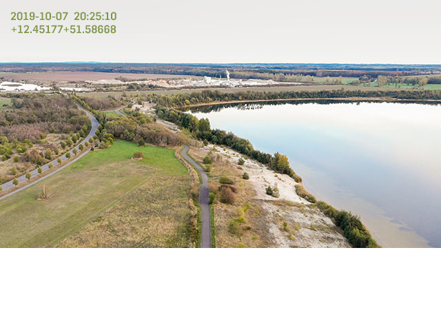
Landscape shot on the lake shore near Bitterfeld on a late afternoon in October

Infrared image 1 without real image overlay

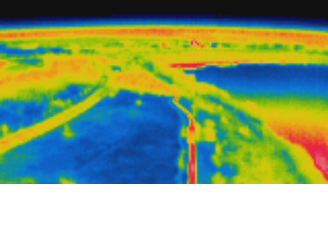
Heat radiation from different surfaces, shown in color.

Infrared image 2 with real image overlay

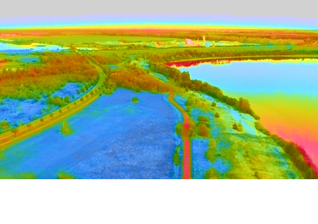
Recording with real image overlay enables the identification of individual structures and shows the different radiation.

Real image

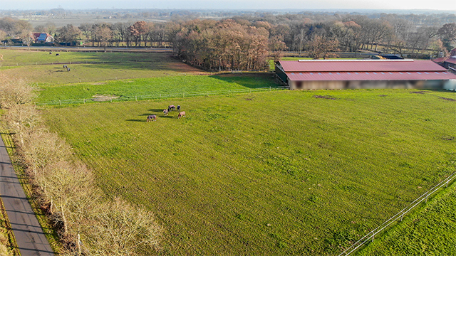
Horses in the pasture one morning in early December (taken from a height of 30 m and approx. 60 m away).

Infrared image 1 without real image overlay

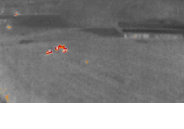
Heat radiation in the "hot spot" display.

Infrared image 2 with real image overlay

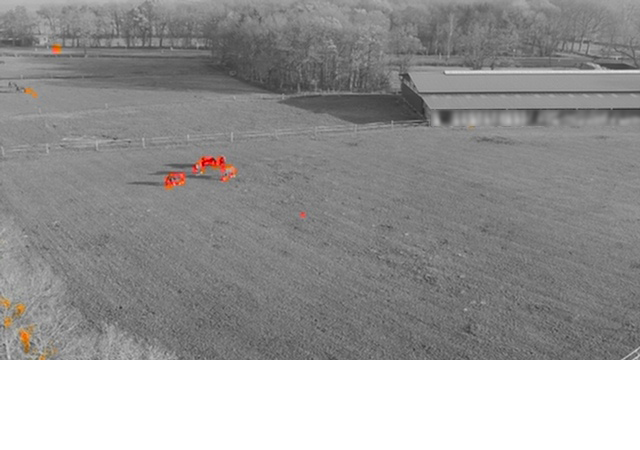
Recording with real image overlay enables the exact localization of the horses based on the identifiable environment (fence).

Real image

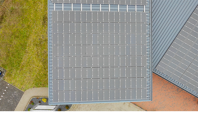
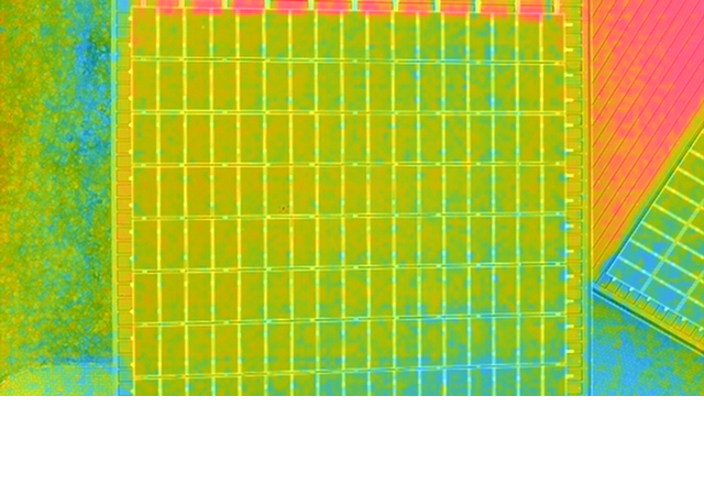
Solar system taken at an angle of 90 degrees from the top in mid-December.

Infrared image 1 without real image overlay

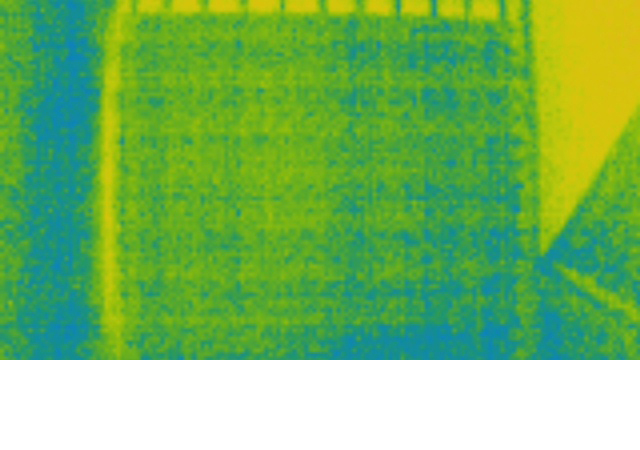
Heat radiation from the solar field, shown in color.

Infrared image 2 with real image overlay

Recording with real image overlay enables the identification of individual panels (measured temperature difference in this example: approx. 1.5 degrees).

gramm takeoff weight
meter hieght (1)
km/h speed
minutes flight time
>